When people think of Cusco, what typically comes to mind is the iconic Incan city located at 3,400 meters above sea level. However, Cusco is also the name of an entire department encompassing a vast variety of landscapes, stretching from alpine highlands all the way to the dense rainforest. Geographically, the province of La Convención accounts for more than half of the department, making it the largest province in the region. In this article, we will explore La Convención’s dynamic geography and discover how this transition, from snow-capped high mountain peaks down to lowland jungle has shaped the culture and history of this fascinating land.
1. Salkantay Snow Peak & Vilcanota River Valley
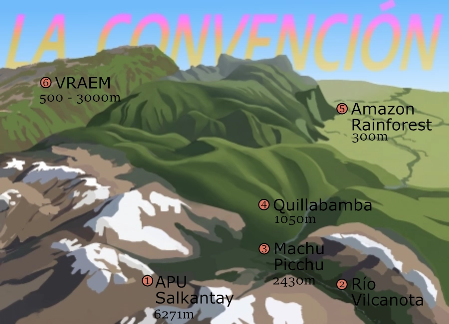
The area’s highest peak is the sacred mountain of Salkantay (number 1 on the image). Local Andean communities regard this peak as a protective guardian spirit that controls weather and agriculture. The famous Salkantay trek hikes past the peak before descending into the valley carved by the Rio Vilcanota (number 2 on the image) and eventually reaching Machu Picchu (number 3 on the image). The Rio Vilcanota, also known as the Rio Urubamba, is one of the source waters of the Amazon River, serving as the primary waterway through the Urubamba Valley until it reaches the Amazon Rainforest (number 5 on the image).
2. Quillabamba: The Cultural & Commercial Crossroads (1,000 MASL)
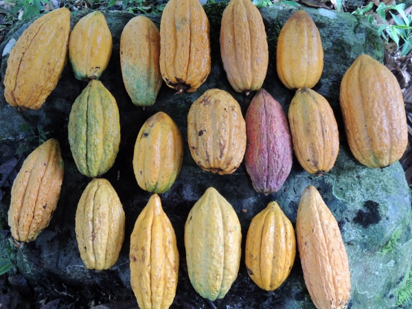
While descending further into the valley, we arrive at Quillabamba (number 4 on the image), the capital city of the province. Historically, this is the place where Andean culture met Amazonian culture. Though the Inca Empire occupied a huge part of South America, they never fully controlled the Amazonian region. The tropical rainforest was just too different for the people from the mountains; they couldn’t stand the heat or the unfamiliar plants and insects. Since the mountain people did not want to go down and the rainforest people did not want to go up, they maintained a friendly business relationship. Quillabamba was selected as the trading location for both worlds due to its 1,000-meter elevation and relatively flat terrain. In the local Quechua language, "quilla" means moon and "bamba" means flat land; trade was usually held on the full moon, hence the name Quillabamba was created. Today, Quillabamba serves as a central hub for coffee and cacao production, benefiting from its proximity to both coffee farms at higher elevations and cacao farms at lower altitudes. This convergence of Andean and Amazonian cultures makes the city uniquely compelling.
3. The VRAEM Basin & Amazon Lowlands
Across the province lies another river system forming a distinct valley: the VRAEM (Valley of the Apurímac, Ene, and Mantaro Rivers, number 6 on the image). While this area resembles the Urubamba Valley, its lack of significant Andean cultural influence makes it distinctly more Amazonian. Both valleys share similar terrain zones and microclimates. Considering the geography of La Convención, there is a dramatic transition from high mountains to low jungle, and two major valleys that traverse the province to eventually reach the Amazon rainforest.